Hurricane Patricia about to hit Mexico
Mexico is bracing for the most powerful hurricane on record. The Category 5 Hurricane Patricia is just hours away from making landfall on the Pacific Coast of Mexico.
The National Hurricane Center says the storm should hit just south of Puerto Vallarta and head inland from there. They have recorded winds of 190-200 miles per hour with gusts up to 235 mph.
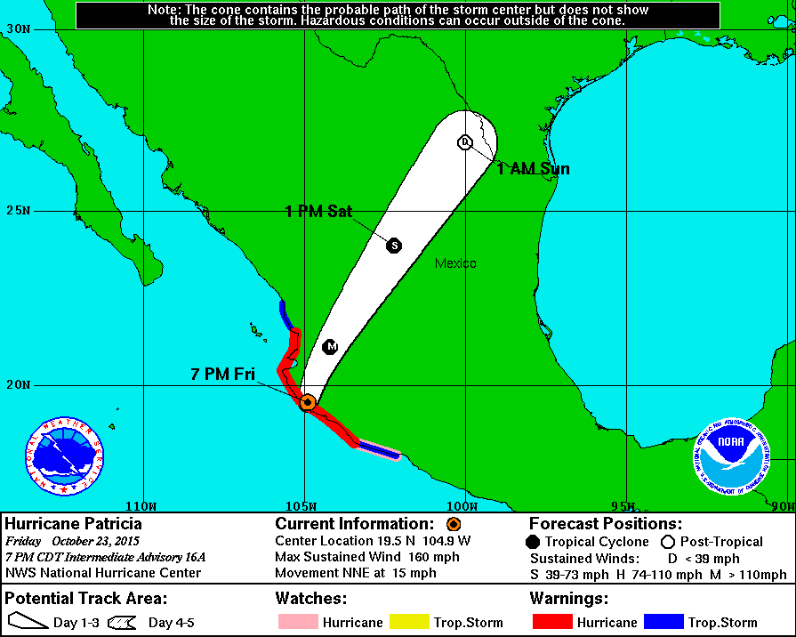
Hurricane Patricia and projected path.
The areas most affected by the storm will be in the state of Jalisco, which includes not only Puerto Vallarta, but also Guadalajara and Manzanillo, which may take the brunt of the storm when it makes landfall. Storm and hurricane scientists are predicting catastrophic damage to the Pacific Coastal areas when Patricia makes landfall.
Even Cabo San Lucas will feel the effects of Hurricane Patricia. The outer bands of wind and rain will hit the resort area, as well as popular areas along the Gulf of California.
Residents and the Mexican government have been preparing for the storm for three days, and reporters from CNN said the roads heading away from the coastal areas have been packed with people trying to avoid the worst of the hurricane. They are expecting catastrophic flooding and mudslides as it moves inland.
People on their way to Mexico for a vacation will want to change their plans. The storm is so big it will affect most parts of the country and even affect weather conditions in the Border States.
The storm is projected to move northeast across Mexico, ending somewhere along the border with Texas.
Southern California residents shouldn’t be surprised if Hurricane Patricia changes course slightly from the projections, which could send rain and some wind our way.
The National Hurricane Center said the storm is fueled by the giant El Niño that is beginning in the Pacific Ocean.
•••• •••• ••••• •••• ••••
Update: Hurricane Patricia made landfall at about 4:15 pm Pacific Time, with sustained winds of 165 mph. The storm hit the town of Emiliano Zapata, about 55 miles northwest of Manzanillo.
The storm is moving in a northeast direction at about 15 mph. The photo to the right is from the National Hurricane Center and they emphasize that the effects of the storm will be felt hundreds of miles beyond the “cone” of the projected path of the hurricane.
Click the photo to enlarge it.
•••• •••• ••••• •••• ••••
UPDATE, SATURDAY OCT. 24: The National Hurricane Center downgraded Hurricane Patricia to a tropical depression at 8 a,m. Pacific Time.
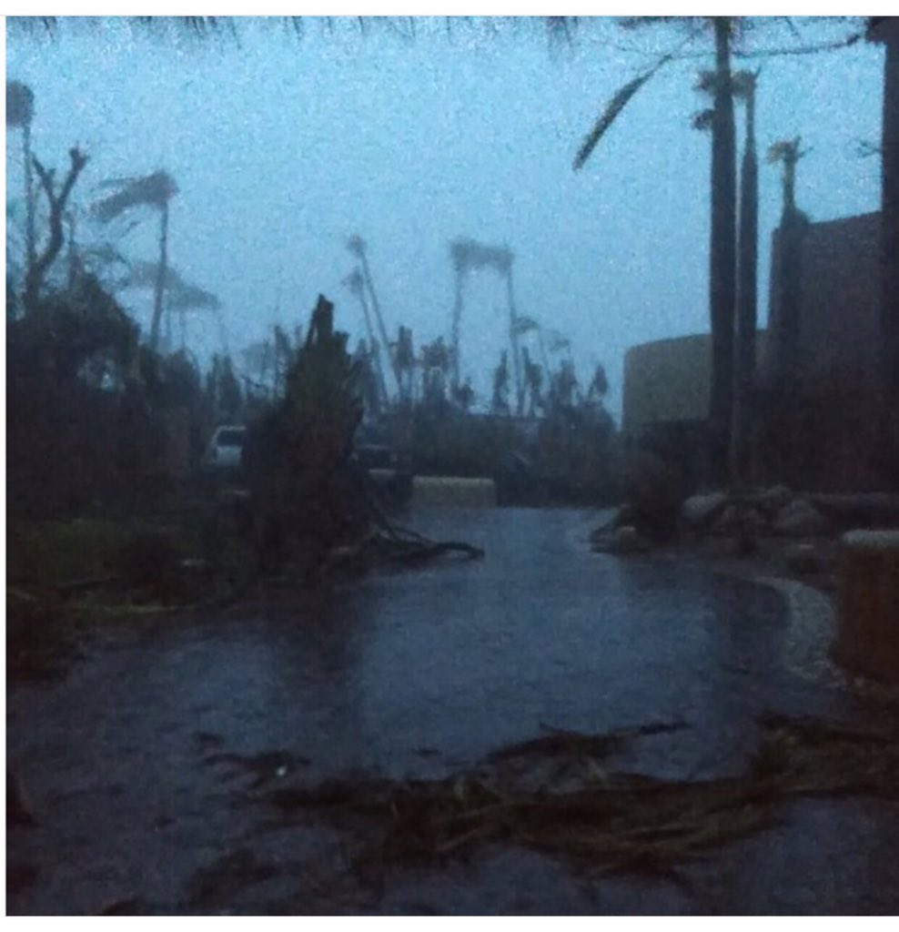
(Enrique Acevedo via Twitter)
Reports from the state of Jalisco, which felt the brunt of the storm, say there were no fatalities and the damage wasn’t as bas as predicted, although major highways are closed due to flooding and mudslides.
Governor from neighboring states also reported the same: less damage than expected and no fatalities. All of the officials say the mountainous area where the hurricane hit probably did a lot to shield highly populated areas like Puerto Vallarta, Guadalajara and Manzanillo from significant damage. They also praised residents who chose to leave the area before Patricia hit, or stayed indoors when it made landfall.
Guadalajara, which is about 180 miles northeast from where Hurricane Patricia made landfall, had shops and other businesses open on Saturday Morning.
Enrique Acevedo of Univision tweeted some photos from the area, including this one from Emiliano Zapata, a town on the coast that was close to the eye of the storm when it made landfall.
Los Angeles Post-Examiner is not the typical news platform. We go beyond headlines, creating a space for fiction writers, poets, comedians and musicians to share their talent and be discovered. Inspired by the Beatles’ vision behind Apple Corps Ltd, they opened the door to all kinds of inspiring talent that never really got a shot. From that came the likes of James Taylor and many others. By providing a similar approach we can shine the light on some tremendous undiscovered talent and at the same time offer some familiar voices who live in Los Angeles and beyond.